Coastal hazards
No coastal flooding or erosion hazard mapped on the site
Fine
Nothing to flag from Council’s coastal hazard maps. No action needed.
Buyers Report · Auckland
Flood paths, landslide zones, coastal hazards and zone changes next door can affect what you can build, what you can insure and what the place is worth. Most buyers only learn about them after the offer is unconditional. A $149 report shows you in 15 minutes, while you can still negotiate or walk away.
Is this your site?
Checking the address is free. You only pay once we know we can produce a report for it.

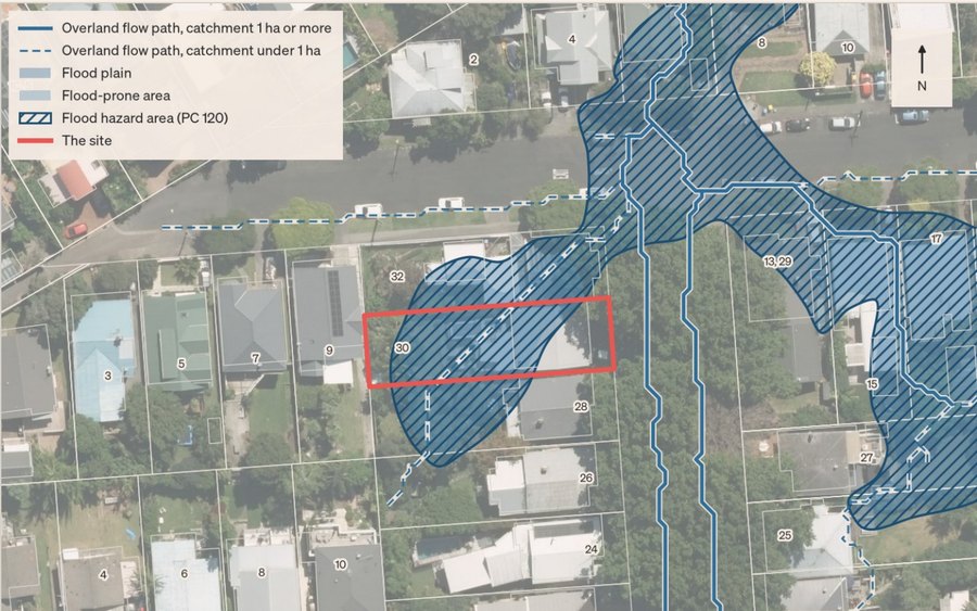 Flooding
A site on a flood plain or overland flow path can mean higher premiums, exclusions, or building restrictions. It’s on Council’s maps, but it isn’t on the listing.
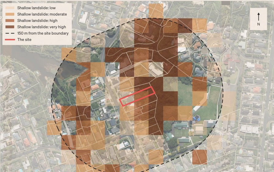 Landslide and slope
Steep or unstable ground can mean specialist engineering and a longer consent process, before a single wall goes up.
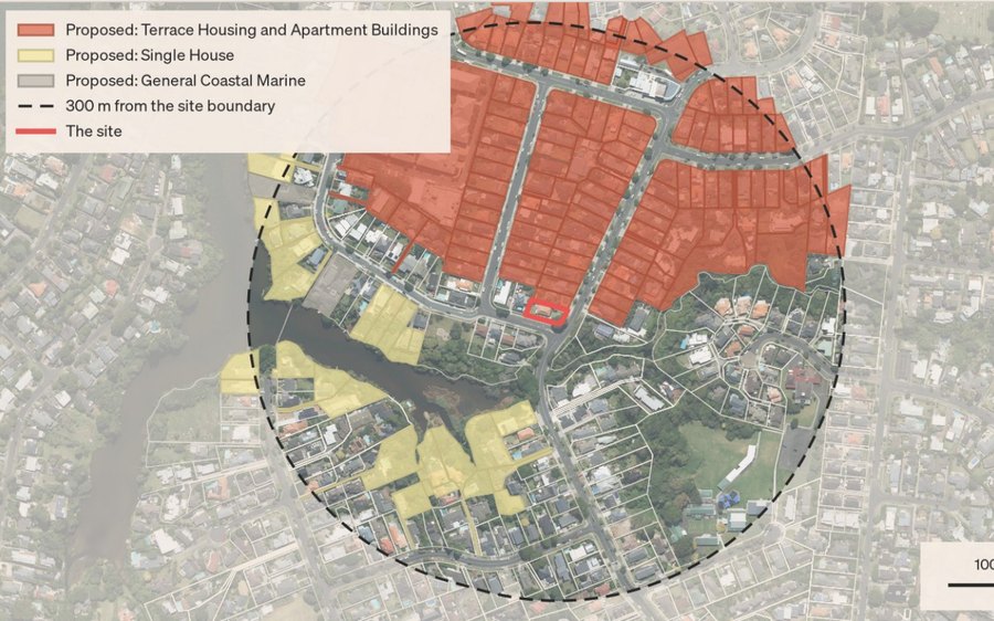 Plan Change 120
Zoning changes next door can affect your outlook, your sunlight and what the neighbours can build.
The zone, the rules for height, setbacks and site coverage, and what Plan Change 120 proposes for the site.
Overland flow paths, flood plains and Council’s flood hazard areas, mapped against the site.
Ground levels from LINZ lidar, the fall across the site, and which way water drains.
Shallow and large-scale landslide, plus coastal flooding and erosion, each with Council’s mapping.
Recent resource consents lodged nearby, and how the neighbours’ zoning may change.
A checklist for your due diligence, built from what the report found on this site.
Every report is about 15 pages, with a map for each hazard and a plain-English line on what it means. Here are four of them.
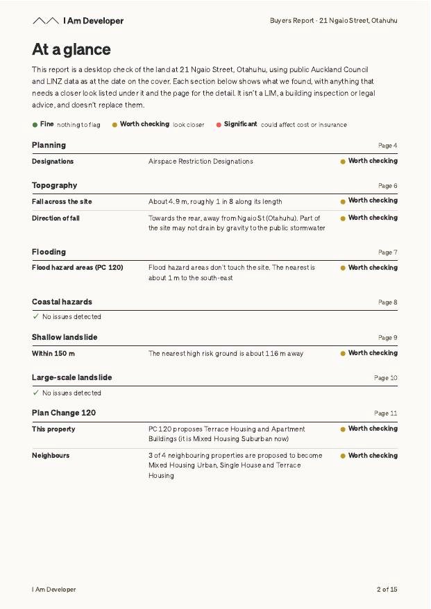
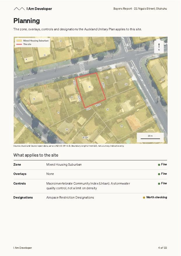
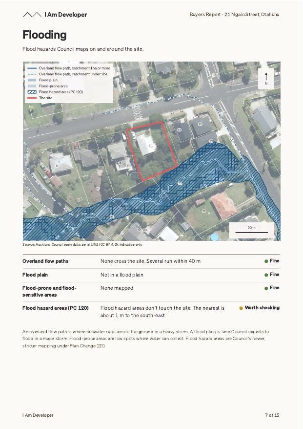
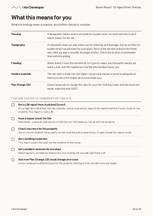
Each report runs a detailed list of Council and LINZ property data through our system, flagging key insights and issues along the way. We sort them into three groups, shown below.
Fine nothing to flagWorth checking look closerSignificant could affect cost or insurance
Coastal hazards
No coastal flooding or erosion hazard mapped on the site
Fine
Nothing to flag from Council’s coastal hazard maps. No action needed.
Plan Change 120
Neighbouring properties are proposed to be rezoned for taller, denser housing
Worth checking
Council proposes to change the zone on properties next door. Nothing is final until decisions are made, expected mid-2027, but it could change what gets built beside you.
Flooding
Flood plain covers most of the site, with an overland flow path through it
Significant
Insurers can decline cover or raise premiums, and Council can limit where and how you build. Get an insurance quote and a drainage engineer’s advice before you make an offer.
The report doesn’t replace a LIM, a building inspection or legal advice. It tells you what to ask them, and what the land can and can’t do, before you pay for the rest.
See the zone, the hazards and the slope before you make an offer.
See what the rules allow if you want to extend, add a home or subdivide.
The checklist names the people to talk to next, and what to ask them.
We look it up in Council records and tell you straight away whether we can produce a report for it.
$149 including GST. One report, no account to set up.
A PDF arrives in your inbox within 15 minutes.
No. A LIM is Council’s official record of a property. This report reads Council’s published map data and turns it into plain English, with a list of what to check next. It doesn’t replace a LIM, a building report or legal advice.
It uses Council and LINZ data, and every page says where its data came from. Council’s hazard maps are modelled, so their edges are approximate. Treat the report as a starting point, not a guarantee.
You’ll find out when you check the address, before you pay. The report covers Auckland properties only.
Yes. The report covers the whole shared site, and says so on the first page.
Yes. Book a 15-minute call and we’ll walk through your report and answer your questions.